このデータベースは、北海道大学附属図書館北方資料室等の所蔵資料を収録した8種の目録を、平成5年から平成20年にかけて「日本学術振興会:科学研究費補助金(研究成果公開促進費)」の交付を受け構築したものです。
ガラス乾板目録は、北海道大学附属図書館所蔵のガラス乾板を、平成25年度「公益財団法人日本科学協会笹川科学研究助成金」の交付を受けデジタル化したものです。
タイトル索引
[
ア
イ
ウ
エ
オ
カ
キ
ク
ケ
コ
サ
シ
ス
セ
ソ
タ
チ
ツ
テ
ト
ナ
ニ
ヌ
ネ
ノ
ハ
ヒ
フ
ヘ
ホ
マ
ミ
ム
メ
モ
ヤ
ユ
ヨ
ラ
リ
ル
レ
ロ
ワ
英字
数字
]
1796件ヒットしました。
全 = 全文あり
/ 画 = 画像あり
/ ![]() = 高画質画像(IIIF)あり
= 高画質画像(IIIF)あり
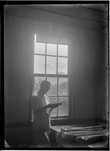
- A. A. Brigham (明治大正期北海道写真目録(明治大正期の北海道・目録編))
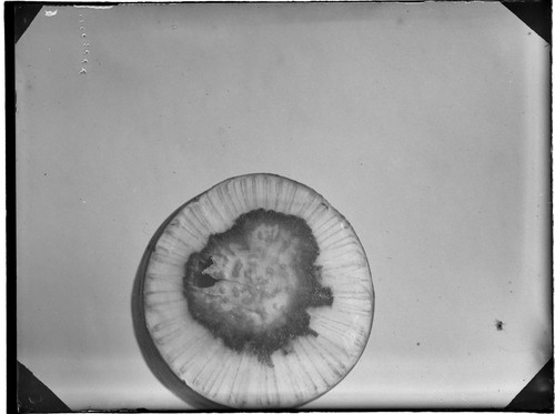
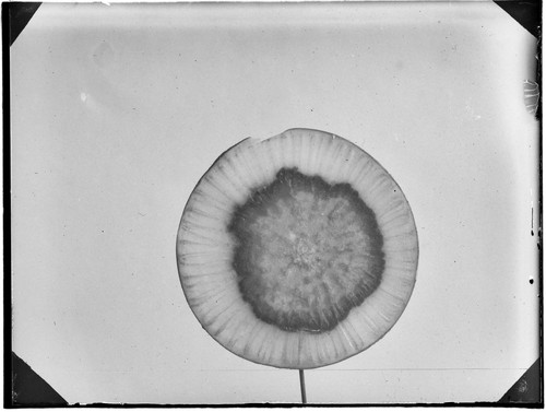
- a radish noor attackel by bacteria (ガラス乾板写真) 画
- a radish noor attackel by bacteria (ガラス乾板写真) 画
- A bibliography of the history of agriculture in the United States / Edwards, Everett Eugene (高岡・松岡旧蔵パンフレット目録)
- A biographical sketch of Dr. K. Sugi, the father of Japanese statistics / Yokoyama, Masao (高岡・松岡旧蔵パンフレット目録)
- A Bird's-eye-view of Otaru. (北海道関係地図・図類目録)
- A brief sketch of the Kwantung Government. / 満蒙文化協会 (旧外地関係資料目録)
- Abriss einer Geschichte der Theorie von den Produktionsfaktoren / Muller, Johannes (高岡・松岡旧蔵パンフレット目録)
- A catalogue of the romanized geographical names of Korea / 小藤文次郎 (旧外地関係資料目録)
- A chapter on the artificial propagation of the brook trout / Titcomb, John Wheelock (高岡・松岡旧蔵パンフレット目録)
- A Chart of the N. E. Coast of Asia, and Japanese Isles. / W. R. Broughton (北海道関係地図・図類目録)
- A Chart of the N. E. Coast of Asia, and Japanese Isles. / W. R. Broughton (北海道関係地図・図類目録)
- A Chart of the N. E. Coast of Asia, and Japanese Isles……under the Command of Wm. Robt. Broughton Esqr. (北海道関係地図・図類目録)
- Acquisition of land : What has been done to cheapen and expedited the acquisition of land by public authorities--and some fallacies. A statement of the present position and the true facts concerning land (高岡・松岡旧蔵パンフレット目録)
- Address on cooperation in the distribution and marketing of farm products / Powell, Georg Harold (高岡・松岡旧蔵パンフレット目録)
- Adolf Damaschke : ein Fuhrer zur Freiheit und Freude / Kassner, Paul (高岡・松岡旧蔵パンフレット目録)
- Adriance buckeye harveting machinery (高岡・松岡旧蔵パンフレット目録)
- AEG Elektrizitat in der Landwirtschaft (高岡・松岡旧蔵パンフレット目録)
- A farm business analysis of 136 farms in Hillsboro County, New Hampshire : Abridged report / W.C. Funk and R.D. Jennings (高岡・松岡旧蔵パンフレット目録)
- Afrika. / A. Herrich (北海道関係地図・図類目録)
- Agenda 1903 (高岡・松岡旧蔵パンフレット目録)
- A General survey of prefectural conditions of Tokyo (高岡・松岡旧蔵パンフレット目録)
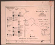
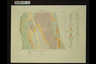
- A Geological Map of the Sorachi Coal Field in Yesso, Japan. (北海道関係地図・図類目録) 画
- A Geological Map of the Sorachi Coal Field in Yesso, Japan. (北海道関係地図・図類目録)
- A Geological Map of the Sorachi Coal Field in Yesso, Japan. (北海道関係地図・図類目録)
- Agrarfrage und Sozialismus / Stein, Alexander (高岡・松岡旧蔵パンフレット目録)
- Agrarlehre und Agrarpolitik der deutschen Romantik / Lenz, Friedrich (高岡・松岡旧蔵パンフレット目録)
- Agricultural economics (高岡・松岡旧蔵パンフレット目録)
- Agricultural education / Dabney, Charles W. (高岡・松岡旧蔵パンフレット目録)
- Agricultural questions : second item of the agenda (高岡・松岡旧蔵パンフレット目録)
- Agriculture in Hokkaido 1982 / 佐々木治夫 (北海道資料パンフレットカード目録)
- Agriculture of Hokkaido / Nakashima,Kuro (高倉文庫パンフレットカード目録)
- Agriculture of Hokkaido / Nakashima, Kuro (高岡・松岡旧蔵パンフレット目録)
- A Group of Ainu in their better kind of Dress (明治大正期北海道写真目録(明治大正期の北海道・目録編))
- A Group of Ainu Women (明治大正期北海道写真目録(明治大正期の北海道・目録編))
- A Group of Penri and his Companions in various Ainu Customs (明治大正期北海道写真目録(明治大正期の北海道・目録編))
- A Group three old Ainu Women (明治大正期北海道写真目録(明治大正期の北海道・目録編))
- A.G.ベイツ氏葬儀通知 / アンチセル (開拓使外国人関係書簡目録) 全
- A Hairy Specimen of Ainu (明治大正期北海道写真目録(明治大正期の北海道・目録編))
- A Hairy Specimen of Ainu (明治大正期北海道写真目録(明治大正期の北海道・目録編))
- A Hydrographic Reconnaissance of the Ishikari River, Island of Hokkaido in Eight Sheets (石狩川測量図) / Day, Murray S. (北海道関係地図・図類目録)
- A Hydrographic Reconnaissance of the Ishikari River, Island of Hokkaido in Eight Sheets (石狩川測量図) / Day, Murray S. (北海道関係地図・図類目録)
- A Hydrographic Reconnaissance of the Ishikari River, Island of Hokkaido in Eight Sheets (石狩川測量図) / Day, Murray S. (北海道関係地図・図類目録)
- Ainu Caravan (明治大正期北海道写真目録(明治大正期の北海道・目録編))
- Ainu Caravan (明治大正期北海道写真目録(明治大正期の北海道・目録編))
- Ainu Women playing on Harp (明治大正期北海道写真目録(明治大正期の北海道・目録編))
- Akademische Gesetze (Studien-Ordnung, Disciplinar-Ordnung und Gesetz uber die Collegiengelder) : zum Gebrauche der Immatriculirten au der k.k. Universitat in Wien (高岡・松岡旧蔵パンフレット目録)
- AKAIGAWA:恵み豊かな大地カルデラの里 / 赤井川村,赤井川観光協会 (北海道資料パンフレットカード目録)
- A,K.Sakurai B, nakamura aug.1920 Photo(Nakamura Sakurai) / 中村 (ガラス乾板写真) 画
- A,K.Sakurai B, nakamura aug.1921 Photo(Nakamura Sakurai) / 桜井 (ガラス乾板写真) 画
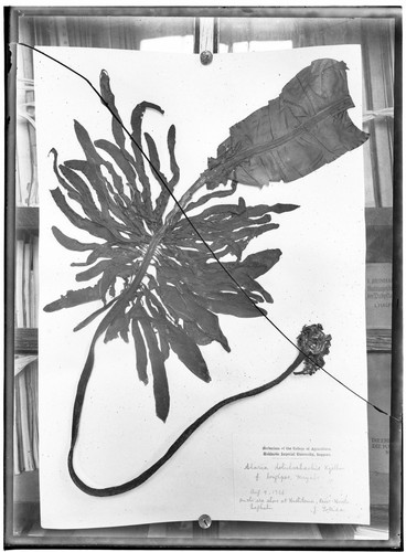
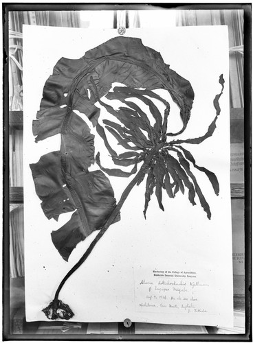
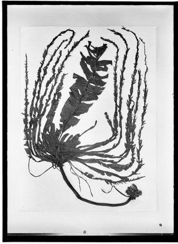
- Alaria dolichorhachis Kjellman van. Longines, Miyabe 9. aug, 26 Hishitoma, prov Honto, Sakhalin Oct. 28, 1926 / 小西 (ガラス乾板写真) 画
- Alaria dolichorhachis Kjellman van. Longines, Miyabe 9. aug, 26 Hishitoma, prov Honto, Sakhalin Oct. 28, 1927 / 小西 (ガラス乾板写真) 画
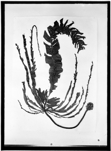
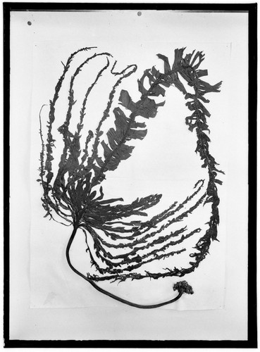
- Alaria vp. nov Kuriles Oct. 4, 1926 / 小西 (ガラス乾板写真) 画
- Alaria vp. nov Kuriles Oct. 4, 1927 / 小西 (ガラス乾板写真) 画
- Alaria vp. nov Kuriles Oct. 4, 1928 / 小西 (ガラス乾板写真) 画
- Aleksandrovsk-Sakhalinskiy (北海道関係地図・図類目録) 画
- Alies maywama miy.et kuci Ptトド (ガラス乾板写真) 画
- A list of Plants of Formosa / 台湾総督府民政部殖産局 (旧外地関係資料目録)
- A Manchu-English dictionary. / Norman, Jerry (旧外地関係資料目録)
- A Manchu monarch;an interpretation of Chia Ch'ing. / Grantham.A.E (旧外地関係資料目録)
- A Map of Kamtschatka, engraved from the Russian Map (北海道関係地図・図類目録)
-
A Map of Sapporo, Island of Hokkaido.
(北海道関係地図・図類目録)
画

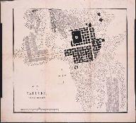
- A Map of Sapporo, Island of Hokkaido. (北海道関係地図・図類目録)
- A Map of the Discoveries made by the Russians on the North West Coast of America. / Royal Academy of Sciences at Petersburg (北海道関係地図・図類目録)
- A Map of the Kurilski Islands, engraved from the Russian Map. (北海道関係地図・図類目録)
-
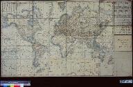
A Map of the World in Japanese.
(北海道関係地図・図類目録)
画
- America,Europe and the Manchuria question. / Millard,T.F. (旧外地関係資料目録)
- American diplomacy concerning Manchuria. / Pan,S.C.Y. (旧外地関係資料目録)
- American influence upon the agriculture of Hokkaido,Japan / Tohoku Imperial University.College of Agriculture (北海道資料パンフレットカード目録)
- American Institute of Co-operation, third summer session, June 20-July 16, 1927 (高岡・松岡旧蔵パンフレット目録)
- American universities / Thwing, Charles Franklin (高岡・松岡旧蔵パンフレット目録)
- An agricultural policy (as presented by a great Japanese writer) / Yamamoto, Miono (高岡・松岡旧蔵パンフレット目録)
- An Ainu Hut (明治大正期北海道写真目録(明治大正期の北海道・目録編))
- An Ainu Hut with a Family Group of Ainu (明治大正期北海道写真目録(明治大正期の北海道・目録編))
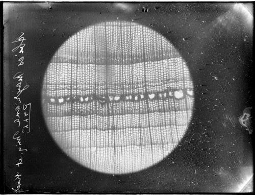
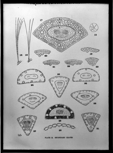
- Analotniy of the Conifeac of leaf = Shaw, G.R. by The GenusPinus / 小西 (ガラス乾板写真) 画
- Analysis of migration of population to and from farms / Galpin, Charles Josiah (高岡・松岡旧蔵パンフレット目録)
- An American shrine in Tokyo : memorial meeting for Townsend Harris held at Zempuku-ji (高岡・松岡旧蔵パンフレット目録)
- An appeal : to make the world brighter (高岡・松岡旧蔵パンフレット目録)
- A national agricultural policy : the finance of occupying ownership and co-operative credit : a study in "cheap money" & "compound interest" / Johnston, John Henry Clifford (高岡・松岡旧蔵パンフレット目録)
- Anatomical characters and identification of Formosan woods;with critical remarks from the climatic point of view with 300 micrographs. By Ryozo Kanehira. / 台湾総督府殖産局 (旧外地関係資料目録)
- Anbauflachen und Ernteergebnisse im Gebiete der Republik Osterreich im Jahre 1921, vergleichen mit den einschlagigen Daten des Jahres 1920 und des zehnjahrigen Durchschnittes (1911-1920) (高岡・松岡旧蔵パンフレット目録)
- An empire insurance society / Johnston, Harry (高岡・松岡旧蔵パンフレット目録)
- An enumeration of plants hitherto known from South Manchuria. / 矢部吉禎 (旧外地関係資料目録)
- An estimate of Negro life and character / Inborden, Thomas Sewell (高岡・松岡旧蔵パンフレット目録)
- An estimate of the population of China in 1929 / Chen, Warren H. (高岡・松岡旧蔵パンフレット目録)
- A new and accurat map of the world drawne according to the truest descriptions, latest discoveries and best observations that have beene made by English or strangers. / Speed, John (北海道関係地図・図類目録(追加収載))
- A New Map of Great Tartary and China, with the adjoyning Parts of Asia, Taken from Mr. De Fer's Map of Asia. Dedicated to His Highness William Duke of Glocester (北海道関係地図・図類目録(追加収載))
- An illustrated ethnography of Formosan aborigines. Vol.1:The Yami / Kano, Tadao (旧外地関係資料目録)
- Annual catalog of Andover public schools, 1911-'12 (高岡・松岡旧蔵パンフレット目録)
- Annual family living in selected farm homes of North Dakota : a preliminary report / Kirkpatrick, Ellis Lore (高岡・松岡旧蔵パンフレット目録)
- Annual production report of manufactured dairy products and oleomargarine, by months, 1921 (高岡・松岡旧蔵パンフレット目録)
- Annual production report of manufactured dairy products and oleomargarine by States-1921. Thousands, i.e., "000" omitted / Prepared by Division of Dairy and Poultry Products (高岡・松岡旧蔵パンフレット目録)
- Annual report for 1911 with the supplement to the "Guide to the Experimental Plots" (高岡・松岡旧蔵パンフレット目録)
- Annual report of the principal of the Calhoun Colored School of Calhoun, Lowndes County, Alabama. 19th-21st (高岡・松岡旧蔵パンフレット目録)
- Annual report to the League of Nations on the administration of the South Sea Islands under Japanese mandate for the year 1921,1925,1933. / 日本政府 (旧外地関係資料目録)
- Annual report, United States Indian School, Carlisle, Pennsylvania, 1909-1912 / By M. Friedman (高岡・松岡旧蔵パンフレット目録)
- Anonyme Karte der Reise Martin Gerritsz. Vries' i. J. 1643 (北海道関係地図・図類目録)
- Anonyme Portugiesische Seekarte (北海道関係地図・図類目録)
- Ansiedlungs-Wegweiser : im Auftrage der Gesellschaft zur Forderung der inneren Kolonisation und der Auskunftsstelle fur Ansiedlungswesen / Schulz, Otto (高岡・松岡旧蔵パンフレット目録)
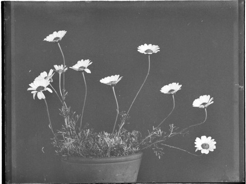
- Anthemis eavpatiea=(Munehen) On the Botanical Garden Sapporo / 小西 (ガラス乾板写真) 画